Kimberlites
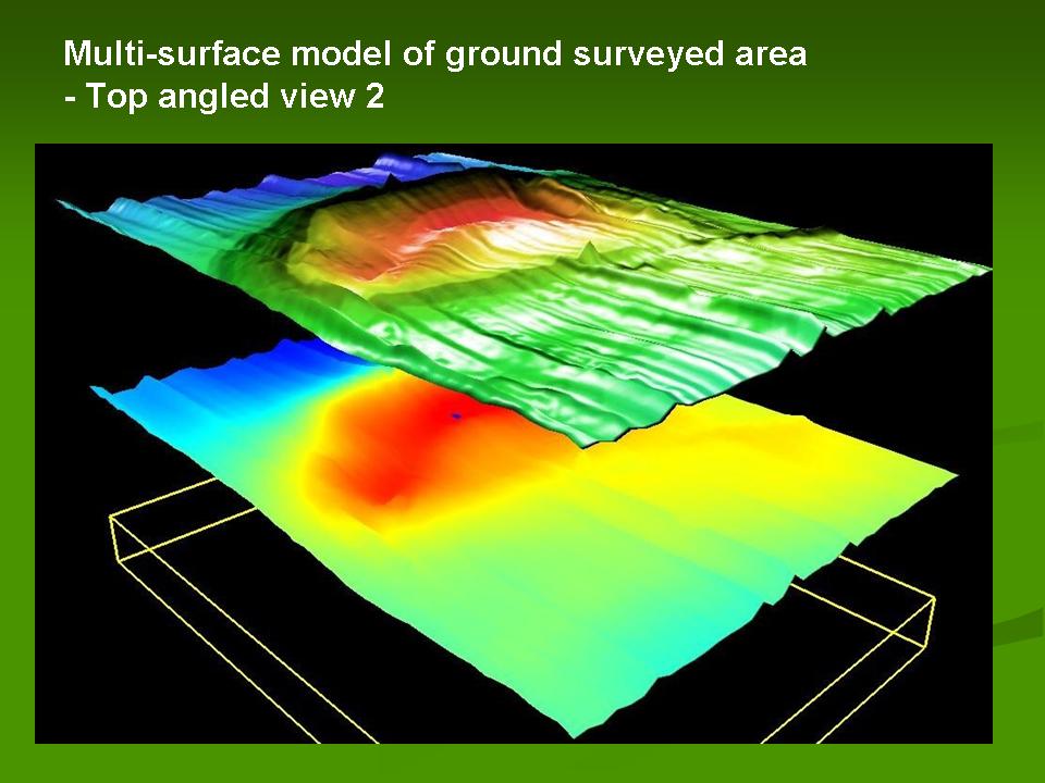
Multi-layer Surface Modelling
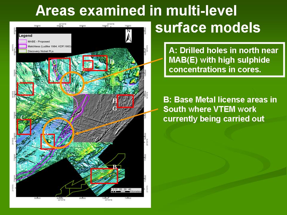
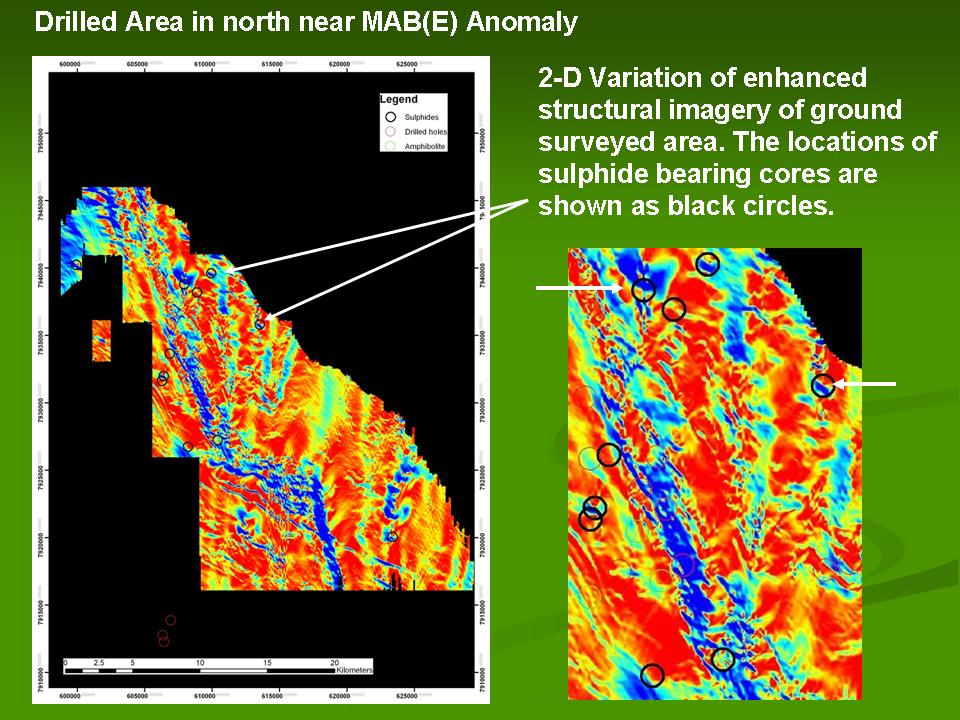
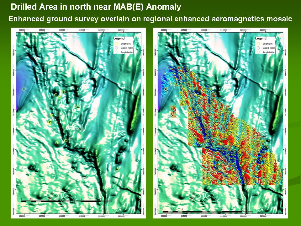
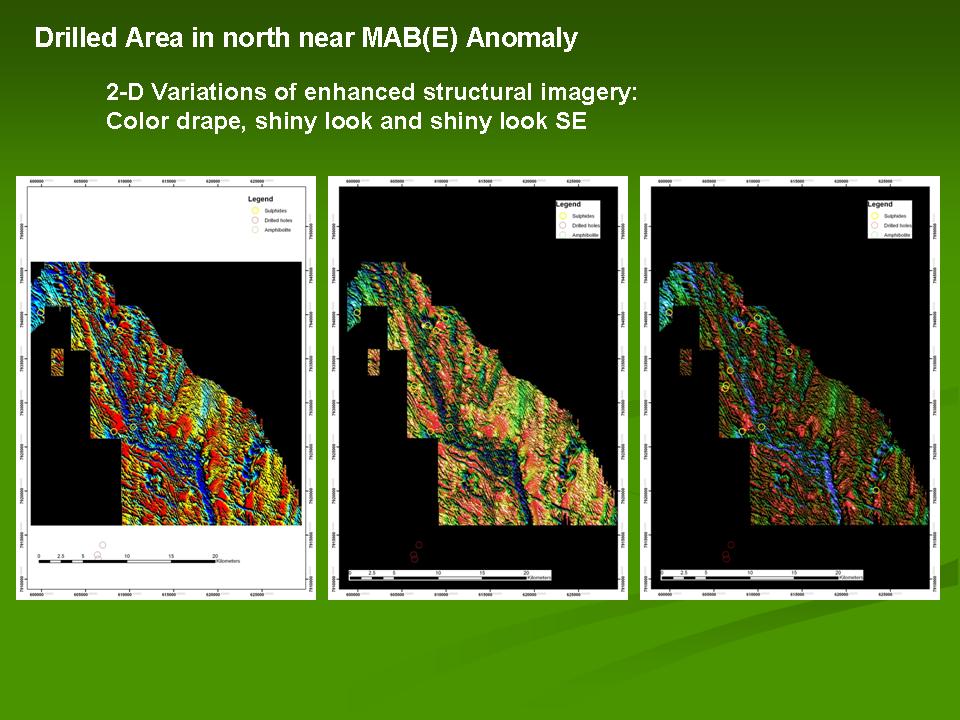
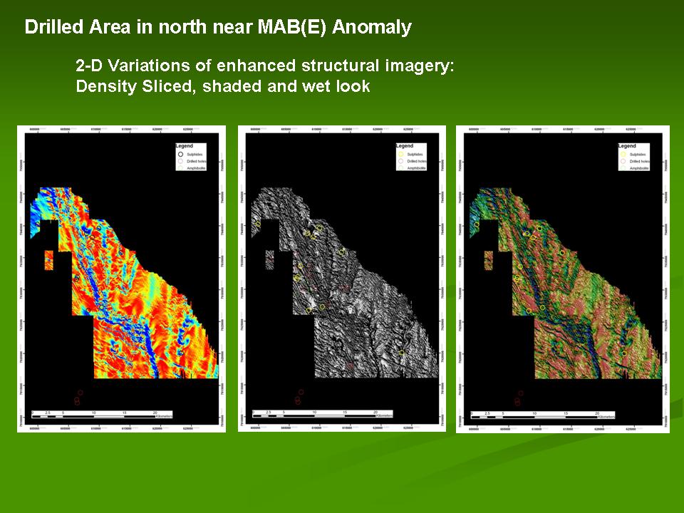
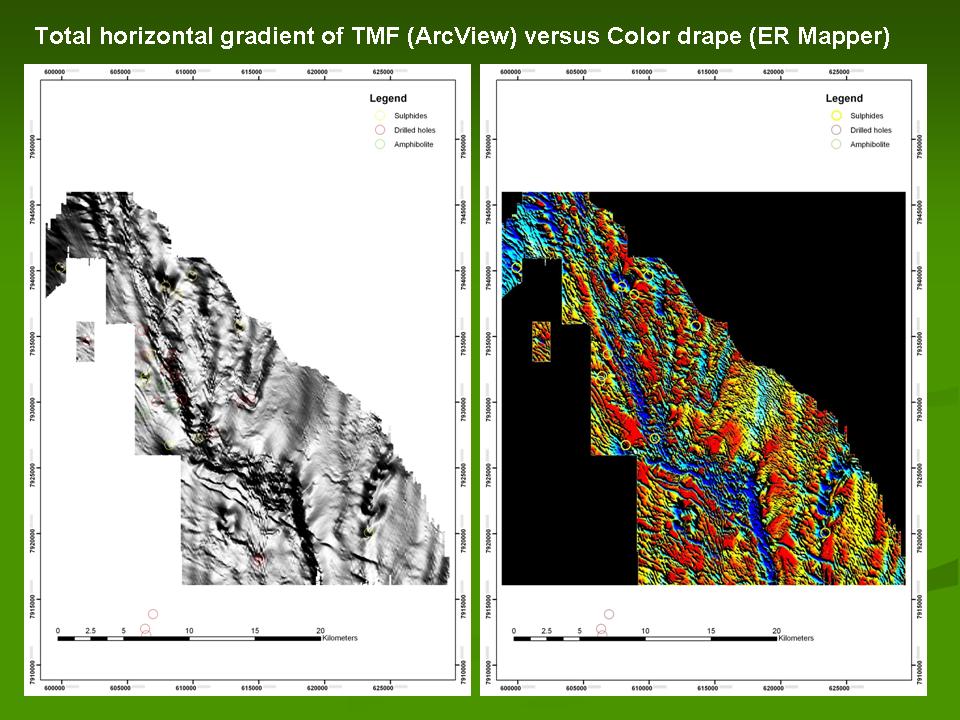
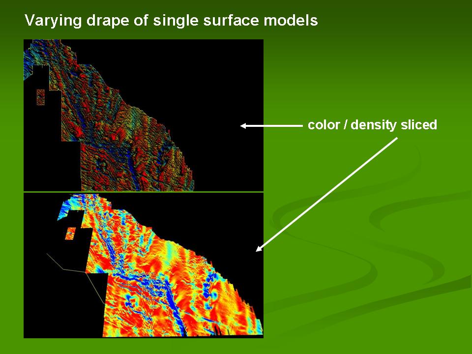
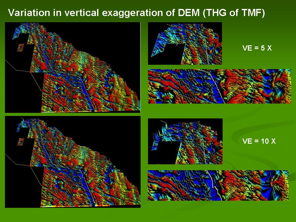
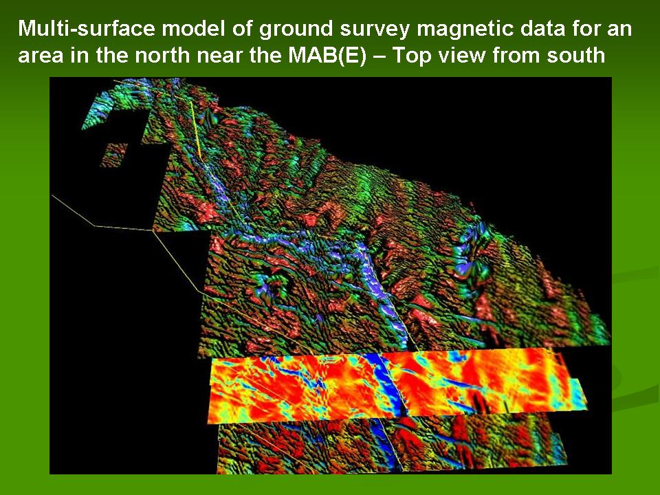
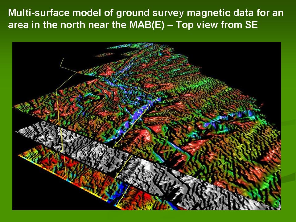
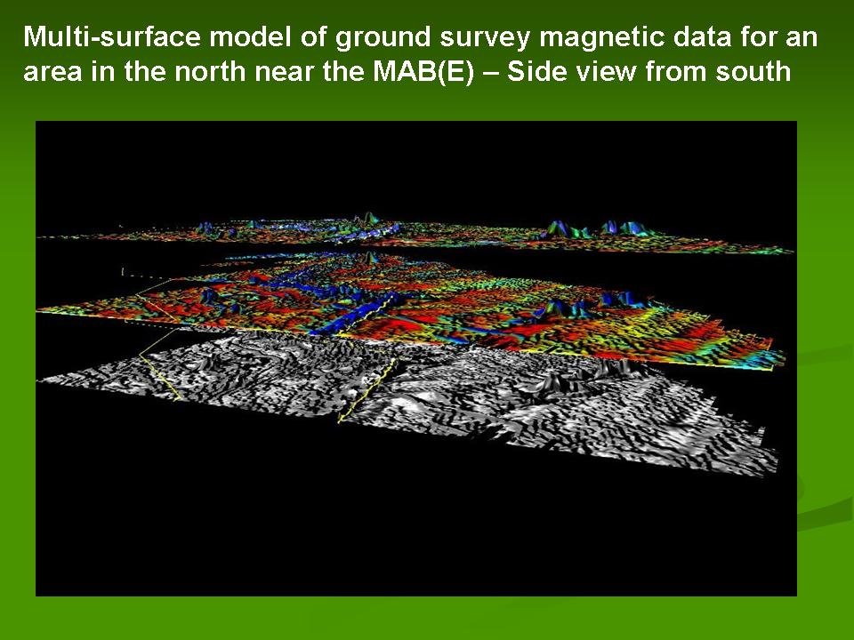
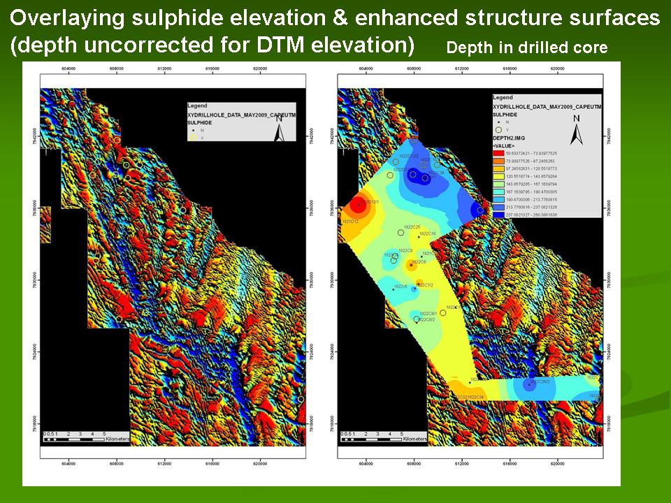
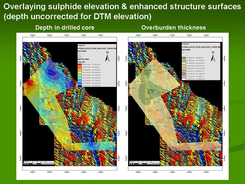
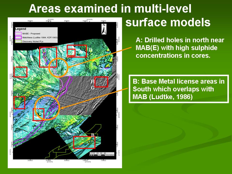
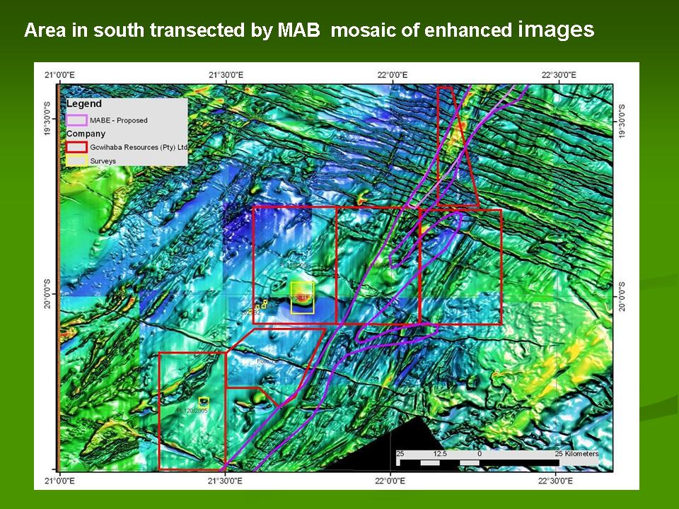
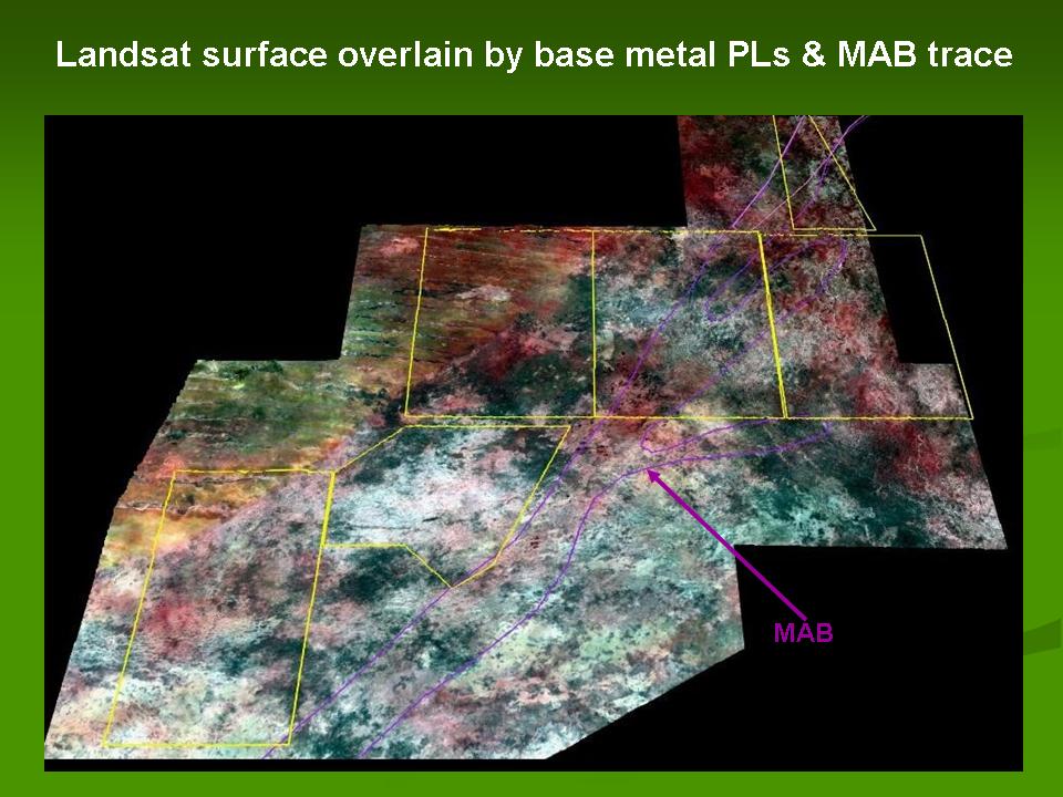
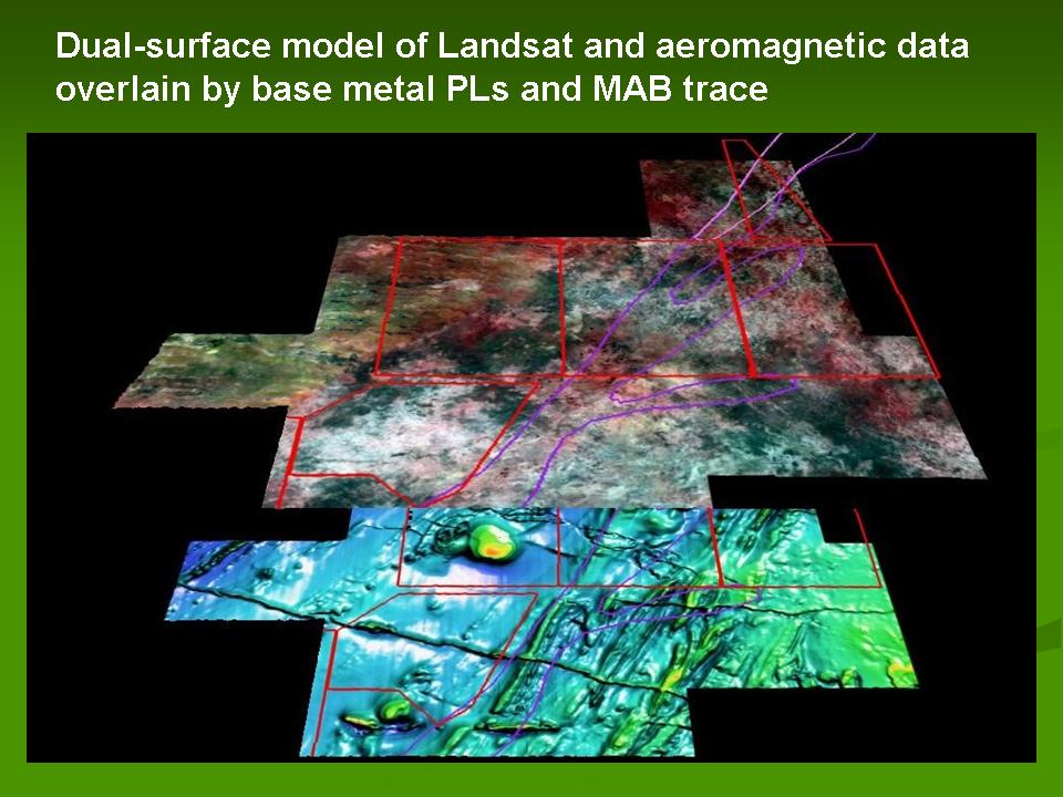
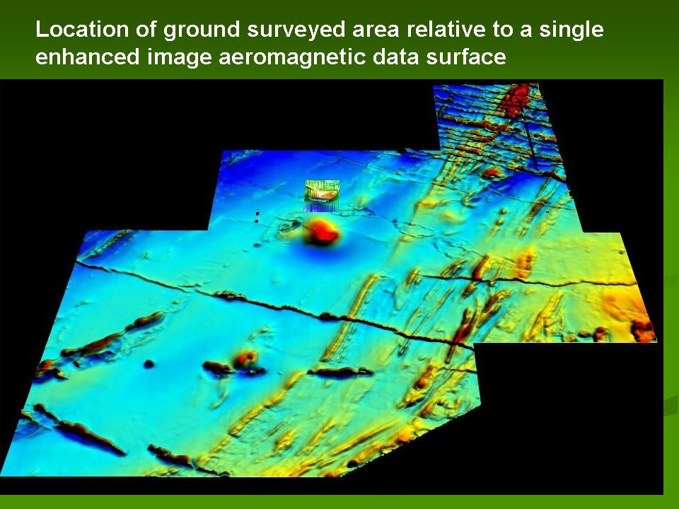
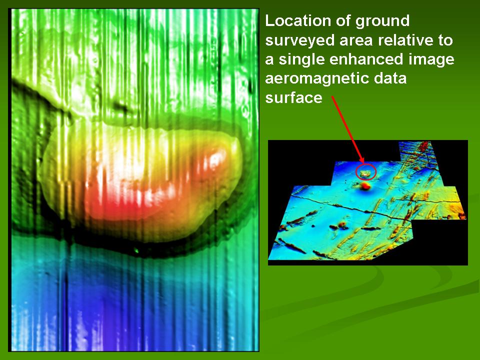
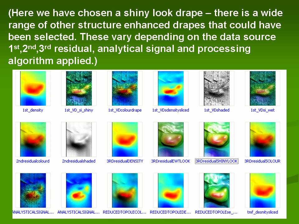
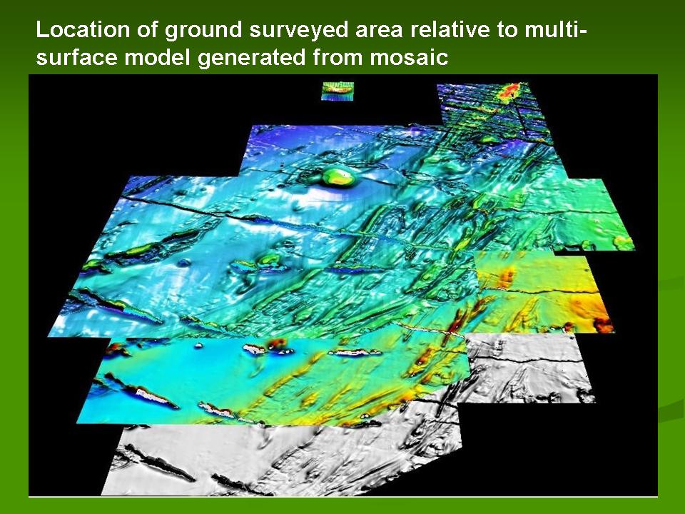
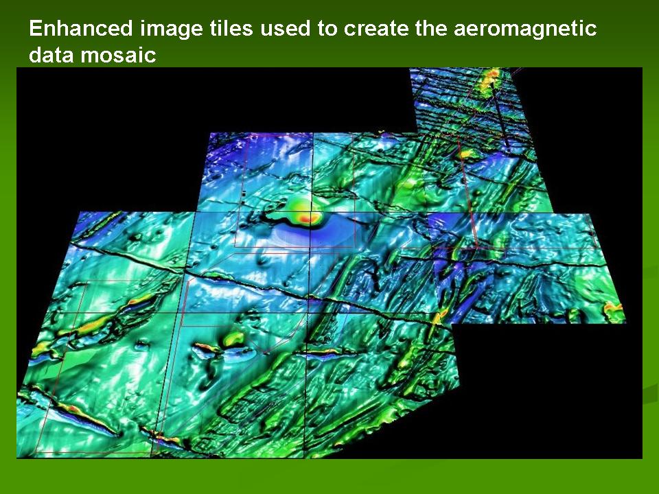
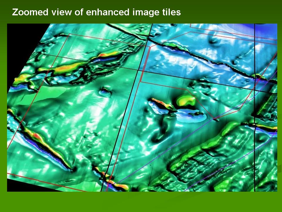
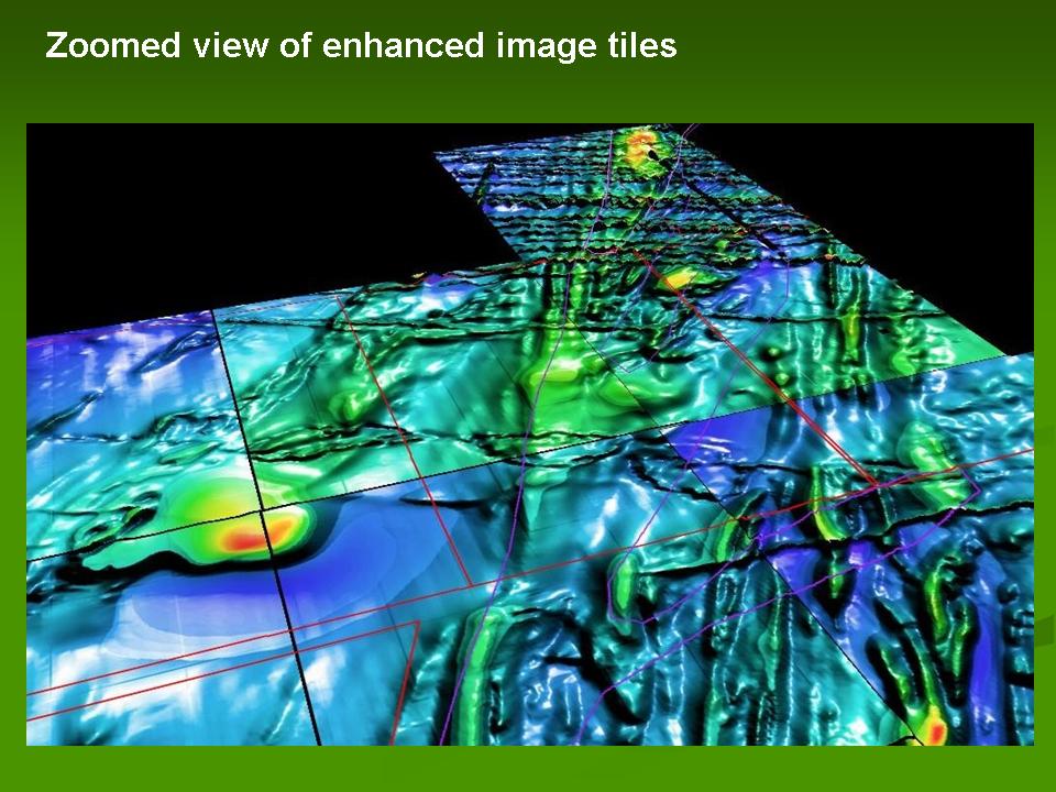
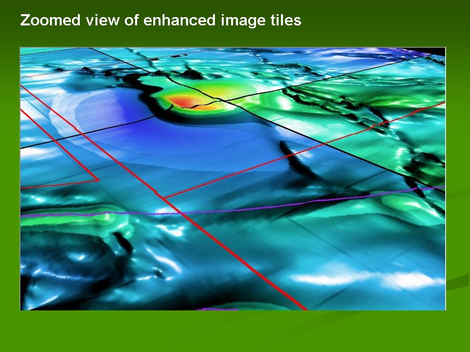
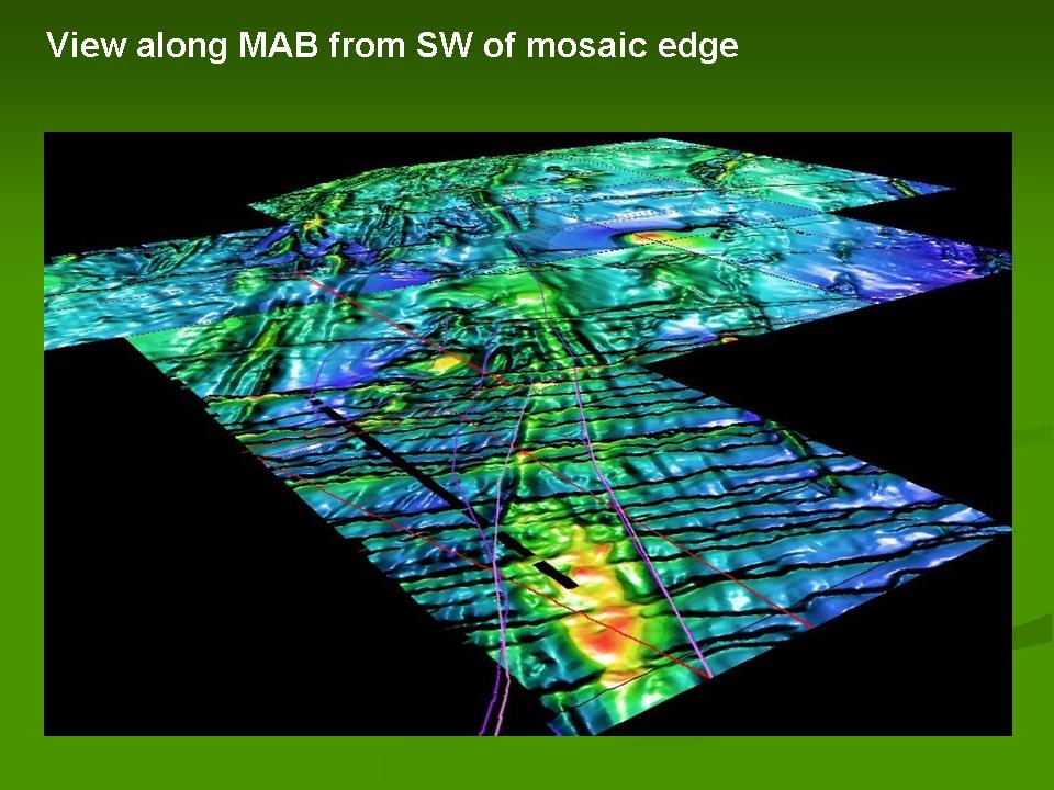
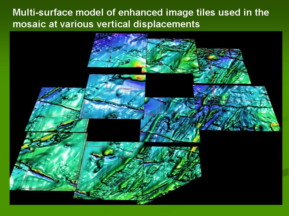
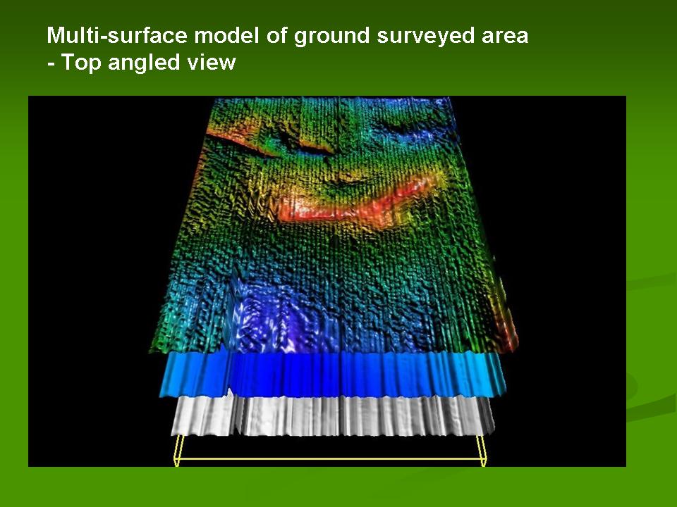
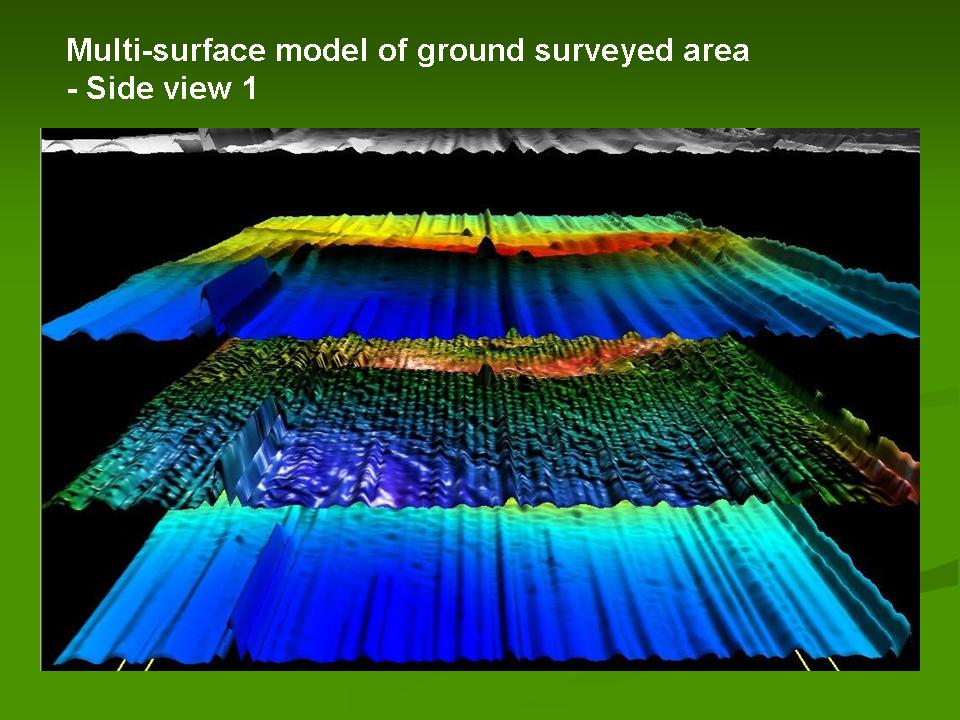
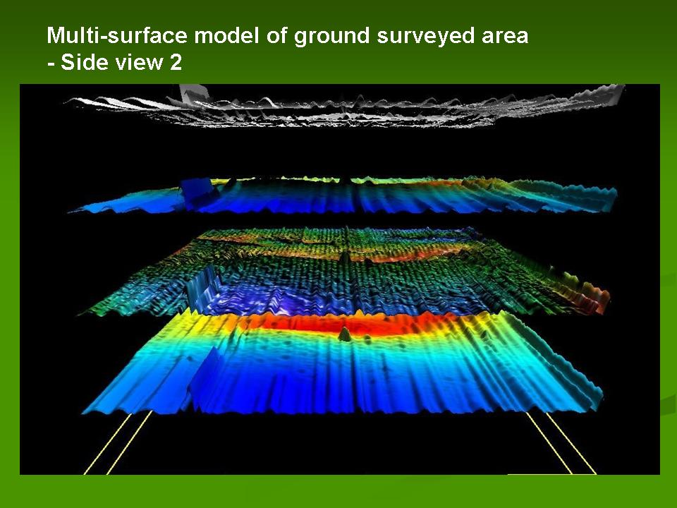
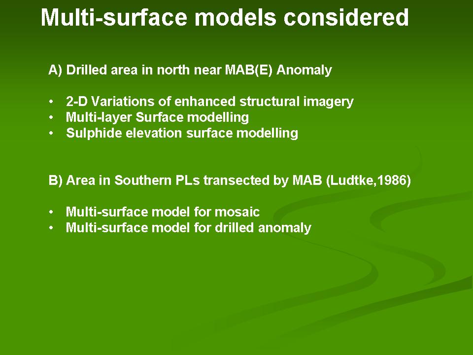
Through my involvement in the Joint Tsodilo Resources - AEON (UCT) research work I have had the opportunity to experience the power of the ERDAS IMAGINE, VirtualGIS, ER Mapper and Titan software firsthand. A series of Multi-layer Surface Models have been examined for the Tsodilo Resources Pty Ltd Base Metal Prospecting License (PL)areas in NW Ngamiland (Botswana). Two areas have been examined one in the southern PL areas and another where drilled sulphides were detected near the MAB(E) as defined by De Wit (2009). The enhanced structural aeromagnetics data imagery created in ER Mapper provide excellent 2-D drapes to apply in the 3-D surface models. The preliminary tests carried out in the ERDAS Imagine Virtual GIS software (see images below) show how this virtual globe environment may be used to stack mutliple variable surfaces at specified intervals. This functionality is particularly useful when attempting to illustrate the overlap in a series of anomalies that are indicative of mineralization potential.
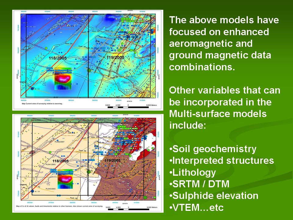
At this point in time only preliminary models based on on enhanced aeromagnetic and ground magnetic data combinations have been used to test the software capabilities / applicability to base metal exploration visualizations. Some of the current and on going work focuses on testing other variables that can be incorporated in the Multi-surface model environment such as:
- Soil geochemistry
- Interpreted structures
- Lithology
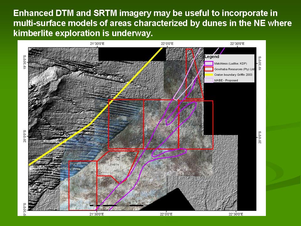
- SRTM / DTM
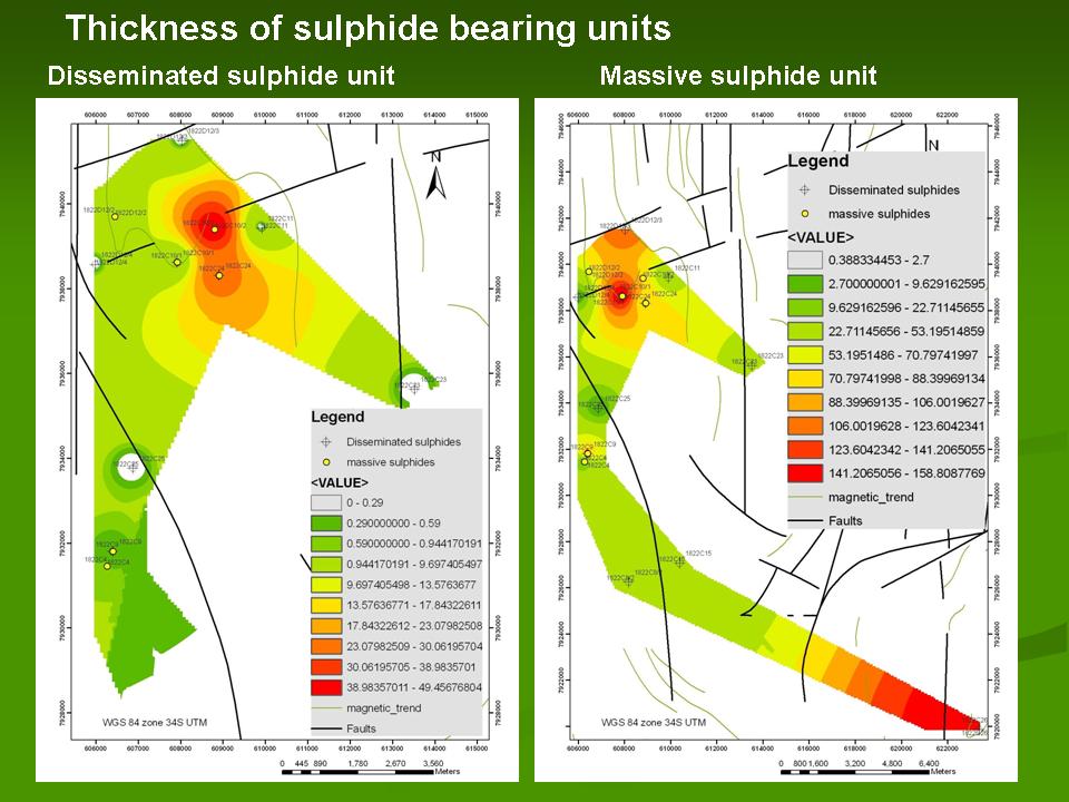
- Sulphide mineralization surface elevation
- VTEM data etc...
The images produced here have been created using the ERDAS ® software. For further information regarding the purchase of this software please contact : Jaurez Dorfling (Head: Geospatial Imaging & GIS); Data Design (t. +27 [0]21 794 2840 | f. +27 [0]21 794 2397 |c. +27 (0) 79 77 88 988 | jaurez@datadesign.co.za| http://www.datadesign.co.za/). The images depicted are part of the outputs of an ongoing Joint Research Programme between Tsodilo Resources and AEON (Africa Earth Observatory Network, UCT) and are copyright of Tsodilo Resources Pty Ltd (©2009). For further information please contact: James M. Bruchs, President & CEO, Tsodilo Resources Limited(www.TsodiloResources.com)(t: +1 416 572 2033|f:+1 416 987 4369|JBruchs@TsodiloResources.com). For further information regarding AEON please contact: Dr Moctar Doucouré, Chief Operating Officer, AEON - Africa Earth Observatory Network,UCT, Tel.: +27(0)21 650 4334; Cell: +27(0)82 705 9072 ; Fax: +27(0)21 650 4915, www.aeon.uct.ac.za
(Click here for gallery viewer.)
|
|
|
Click on images to view higher resolution versions where available.
Website © copyright GISCAPETOWN 2006-2009
All rights reserved worldwide. All photographs and illustrations reproduced on this site are protected under copyrights by their lawful owners.
For the use or reproduction of any material from this website, for prior permission please contact: uma@giscapetown.com
|
Acknowledgements
The following examples are derived from work carried out for Tsodilo Resources Pty Limited (2009). Please refer to the Tsodilo Resources website for further details on the diamond and base metal exploration projects mentioned here and for information on private placements.
|